The Other Southern Utah

Southern Utah contains some of the nation’s last great wilderness areas. Deep canyons weave an intricate web through the ochre bluffs — connecting mountain streams to the desert’s greatest rivers. Exploring these canyons can provide a lifetime’s worth of adventure. The best-kept secrets begin to reveal themselves the more time you spend poking around this remote area. This is a land of contrasts; ancient Indian petroglyphs and stone dwellings are tucked away in sandstone caves while a vibrant local food scene is taking root just 10 miles away.
These great expanses of public land are ideal for multi-day backpacking trips, but day hikes can be equally rewarding. Use this trip report to get the ideas flowing and then craft your journey based on your own interests and outdoors skills.
Start your adventure far from the tour buses and long lines of Moab and Zion. Begin at Capitol Reef National Park, camping in the historic town of Fruita. The fruit orchard and green grass provide a camping oasis situated in the midst of huge sandstone towers. If you can, time your visit to coincide with the annual summer fruit harvest to enjoy sublime peaches, their juices concentrated by the blazing desert sun.

Orchard in Bloom: Fruita Campground, Capitol Reef National Park
The park offers an infinite selection of hikes and ethereal views over the bizarre rock formations, from easy meanders around the sandstone bluffs to canyoneering through slot canyons. Look up one of the many adventure outfitters in Torrey if you’re game to try something like rappelling off Cassidy Arch. Afterwards, there are several dining options in the nearby town of Torrey – Café Diablo is a good bet, especially if you’re interested in trying some rattlesnake cakes (like crab cakes, desert-style).
Scrambling up one of the many rock spires in Capitol Reef National Park
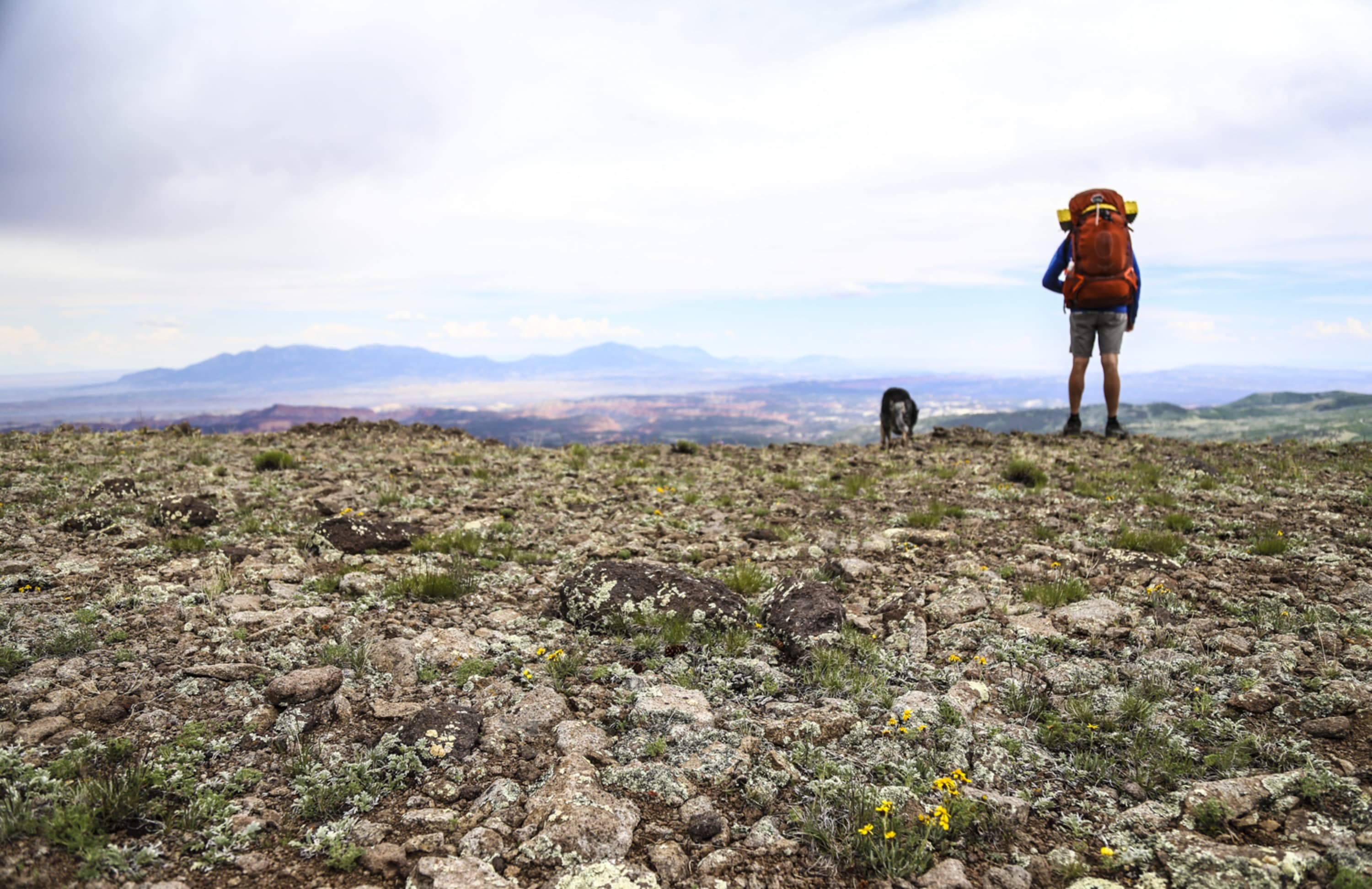
For the next leg of the trip, stock up on snacks or camp food in Torrey and drive the Scenic Byway over Boulder Mountain. If the hot low elevation temperatures have you wilting, consider spending the night at one of the many campgrounds on the mountain and enjoy a cool evening in the evergreen and aspen forest. The campground at Lower Bowns reservoir is a great place to bring fishing rods, kayaks, SUPs, or pool floaties and get your water fix. In the morning, stop at the Wildcat Ranger Station for hiking information and coffee and biscuits kept warm on the wood stove in the warden’s cabin.

Panoramic vistas from the Rim Trail between Chokecherry Point and Bowns Point, Boulder Mountain
Boulder Mountain, also called the Aquarius Plateau, is a huge (50,000 acres) forested area with a high point of 11,300 feet. Many of the hiking options offer expansive views of the canyon lands far below, and Bowns Point is a wonderful place to catch the sunset with 280° views of the Henry and San Juan mountains, with Monument Valley in the far distance.

Camping at Meeks Lake, Boulder Mountain
Continue over the mountain to the small town of Boulder, and consider stopping at one of the incredible eating establishments for a meal (or spend a day eating your way through town..after that hike on the mountain, you deserve it).
- Hell’s Backbone Grill – Treat yourself. The owners run an organic farm and grow much of their own food – the fresh produce makes all the difference, and the southwestern flavors never disappoint. Goat cheese fondue, black pepper buttermilk biscuits & sage butter, local trout.. And a wine list to match.
- Magnolia’s Street Food – This new food truck run by a local couple serves flavorful, fresh, made-to-order Mexican food. Nearly a reason to drive to Boulder on its own.
- The Burr Trail Grill – At the intersection of the two main roads in town, stop in for a burger, or go dessert first with a piece of homemade fruit pie.

Winding desert roads: driving the Burr Trail
From here, you can go one of two ways: southeast down the Burr Trail and back towards Capitol Reef, or south on Route 12 towards Escalante. Both offer different but equally interesting hiking options. But for this trip, let’s take Route 12 because it provides access to my favorite swimming hole. Leaving Boulder, head for Calf Creek. The campground here is in high demand, and for good reason. Lower Calf Creek falls is one of the most beautiful waterfalls in the area, while Upper Calf Creek Falls is the perfect height to jump off into a clear deep pool which is great for cooling off on a hot day. Do both hikes if you have time, and camp in the canyon-bottom campground near the clear, gurgling stream.
The next morning, round your trip out with one the area’s famous slot canyons. Continue on Route 12 for about 15 miles until you see a sign for the Hole-In-The-Rock Road. This dirt road leads south to many trailheads, but for a quick taste of what this area has to offer, check out Peekaboo & Spooky or Zebra Canyon.
Zebra Slot Canyon, filled with water during the unusually wet spring of 2015
Slot canyons offer a thrilling challenge of exploration; their gracefully sculpted curves beckon you deeper. But don’t take my word for it, go see for yourself!
On your way home, stop through the town of Escalante, nearby Kodachrome Basin, or Bryce Canyon National Park. This roadtrip can be done over a long weekend, but you really need a week or more to get deeper into the canyon wilderness and vibrant local culture.
For me, this is the best of the southwest.

Words and photos by Mary MacIntyre
Mary is a freelance writer and photographer based in Salt Lake City, Utah. She can most often be found in the mountains – on skis, in a climbing harness, or hitting the trail in her running shoes. She loves a good cappuccino and long walks in the snow. Follow her adventures on Instagram.
Recent Posts
Synchronous Fireflies: Your Guide to the Great Smokies’ Annual Light Show in 2024
Up and down the Eastern US, fireflies (or lightning bugs) are an essential part of summer nights, twinkling against the…
Morel Mushroom Hunting Season: The 2024 Camping Guide
Spring is springing. And we all know what that means—the 2024 morel mushroom season is underway. To increase your chances…
Top Wildflower Hikes in the Great Smokies
Great Smoky Mountains National Park glows every shade of green in spring and early summer, its lush forest landscape featuring…
These Hipcamp Hosts are Making the World a Better Place
We couldn’t be more proud to partner with thousands of incredible Hipcamp Hosts who share their land with others, opening…
Where to See Bluebonnet Fields in Texas This Spring
As the days grow warmer under the Texas springtime sun, the green spaces along the roads and highways of the…
Host Spotlight: How These Texas Retirees Have Maintained a Perfect Rating for 7 Years
Landowners are partnering with Hipcamp to earn extra money by connecting their properties with folks looking to stay and camp…